Geolocate

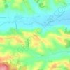
Colomiers topographic map

Click on the map to display elevation.

About this map

Name: Colomiers topographic map, elevation, terrain.

Location: Colomiers, Toulouse, Haute-Garonne, Occitania, Metropolitan France, 31770, France (43.58931 1.28232 43.63402 1.36676)

Average elevation: 168 m

Minimum elevation: 139 m

Maximum elevation: 191 m

Other topographic maps

Click on a map to view its topography, its elevation and its terrain.
Crouzet

France > Occitania > Haute-Garonne > Saint-Gaudens

Average elevation: 374 m

Luquets

France > Occitania > Haute-Garonne > Buzet-sur-Tarn

Average elevation: 133 m

La Lune

France > Occitania > Haute-Garonne > Terrebasse

Average elevation: 321 m

Montagnac

France > Occitania > Haute-Garonne > Saint-Frajou

Average elevation: 294 m

Petit Jean

France > Occitania > Haute-Garonne > Lapeyrère

Average elevation: 324 m

Gear up for your next adventure:

🌬️Windproof Camp Stove - Efficient cooking even on exposed mountain peaks
🥾Trekking Poles - Adjustable trekking poles to reduce knee stress and improve stability
⛺Camping Groundsheet - Protect your tent from moisture and dirt
🥾Trail Running Boots - Durable shoes designed for trail running
🎒Hiking Backpack - Lightweight and ergonomic backpacks for day hikes or multi-day treks

As an Amazon Associate, this site earns from qualifying purchases at no extra cost to you.