Geolocate
👉 Easily get elevation data in JSON, GeoTIFF and KML formats using Elevation API
Thank you for supporting this site ❤️
Make a donation

Valica topographic map

Click on the map to display elevation.

About this map

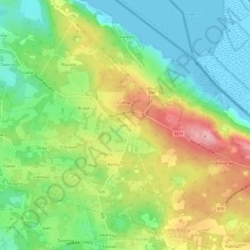
Name: Valica topographic map, elevation, terrain.

Location: Valica, Valica - Valiza, Grad Umag, Istria County, Croatia (45.44787 13.55002 45.48787 13.59002)

Average elevation: 53 m

Minimum elevation: -2 m

Maximum elevation: 128 m

Gear up for your next adventure:

❄️Traction Ice Cleats - Slip-on spikes for icy trails and winter hiking
🛶Waterproof Dry Bags - Keep electronics and clothes dry during river crossings
🥾Hiking Leggings - Comfortable leggings for outdoor activities
🧥Ultralight Puffy Jacket - Maximum warmth that packs down to the size of an orange
🔦LED Headlamp - Hands-free lighting for early morning starts or late finishes

As an Amazon Associate, this site earns from qualifying purchases at no extra cost to you.