Geolocate

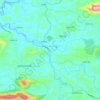
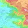
Kanichar topographic map

Click on the map to display elevation.

About this map

Name: Kanichar topographic map, elevation, terrain.

Location: Kanichar, Iritty, Kannur District, Kerala, 670674, India (11.88596 75.76587 11.92596 75.80587)

Average elevation: 105 m

Minimum elevation: 58 m

Maximum elevation: 234 m

Other topographic maps

Click on a map to view its topography, its elevation and its terrain.
Ulikkal

India > Kerala > Iritty > Nuchiyad

Average elevation: 161 m

Aralam

India > Kerala > Iritty > Iritty

Average elevation: 86 m

Kelakam

India > Kerala > Iritty > Adakkathodu

Average elevation: 324 m

Iritty

India > Kerala > Iritty

Average elevation: 65 m

Kottiyoor

India > Kerala > Iritty > Ambayathode

Average elevation: 394 m

Aralam WLS

India > Kerala > Iritty > Adakkathodu

Average elevation: 462 m

Gear up for your next adventure:

🛶Kayak Dry Bag - Waterproof storage for kayaking adventures
🧤Thermal Hiking Gloves - Grip-enhanced gloves for cold-weather altitude trekking
🥾Trail Hiking Boots - Supportive boots for rough trails
🥾All-Terrain Hiking Boots - Versatile boots for varied hiking conditions
🧦Merino Wool Socks - Moisture-wicking comfort for long-distance hiking

As an Amazon Associate, this site earns from qualifying purchases at no extra cost to you.