Geolocate

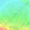
Bilbeis topographic map

Click on the map to display elevation.

About this map

Name: Bilbeis topographic map, elevation, terrain.

Location: Bilbeis, Al Sharqia Governorate, 44621, Egypt (30.25876 31.40463 30.57876 31.72463)

Average elevation: 42 m

Minimum elevation: 2 m

Maximum elevation: 209 m

Other topographic maps

Click on a map to view its topography, its elevation and its terrain.

10th of Ramadan

Egypt > Al Sharqia Governorate

Average elevation: 104 m

Gear up for your next adventure:

⛺Backpacking Tent - Lightweight tent for long-distance hiking trips
💡Portable Camping Lamp - Rechargeable lamp for campsite lighting
🥾Approach Shoes - Shoes designed for climbing approaches and rugged trails
💡LED Camping Lantern - Illuminate your campsite with long-lasting lanterns
🎒Hiking Backpack - Lightweight and ergonomic backpacks for day hikes or multi-day treks

As an Amazon Associate, this site earns from qualifying purchases at no extra cost to you.