Geolocate

Duranda topographic map

Click on the map to display elevation.

About this map

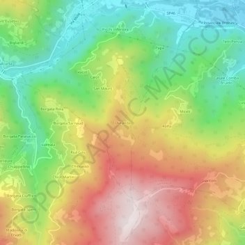
Name: Duranda topographic map, elevation, terrain.

Location: Duranda, Brossasco, Cuneo, Piedmont, Italy (44.52781 7.34315 44.56781 7.38315)

Average elevation: 928 m

Minimum elevation: 555 m

Maximum elevation: 1,383 m

Gear up for your next adventure:

🚲Heavy Duty Bike Lock - Secure your bike at the trailhead or during stops
Camping Tent - Weather-resistant tents suitable for 2 to 6 people
💡Solar Camping Lamp - Eco-friendly lighting for campsites
🧴Bear Spray Holster - Quick-access carry for essential Canadian wilderness safety
🌡️Emergency Mylar Blankets - Compact thermal protection for unexpected nights outdoors

As an Amazon Associate, this site earns from qualifying purchases at no extra cost to you.