Geolocate

Curup topographic map

Click on the map to display elevation.

About this map
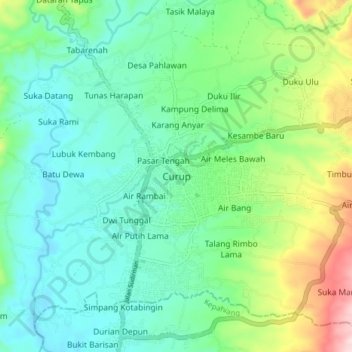
Name: Curup topographic map, elevation, terrain.

Location: Curup, Rejang Lebong, Bengkulu, Indonesia (-3.50762 102.49011 -3.42762 102.57011)

Average elevation: 677 m

Minimum elevation: 585 m

Maximum elevation: 934 m

Gear up for your next adventure:

🩹Moleskin Blister Pads - Direct protection for painful foot pressure points
🧴Outdoor Sunscreen - High SPF protection for high-altitude UV exposure
🦟Insect Repellent - Keep mosquitoes and black flies away in wooded areas
🕶️Polarized Sunglasses - Reduces glare from snow and water at high elevations
🧤Thermal Hiking Gloves - Grip-enhanced gloves for cold-weather altitude trekking

As an Amazon Associate, this site earns from qualifying purchases at no extra cost to you.