Geolocate

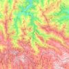
Picos Albos topographic map

Click on the map to display elevation.

About this map

Name: Picos Albos topographic map, elevation, terrain.

Location: Picos Albos, Éndriga, Somiedo, Asturias, España (43.03358 -6.13254 43.05358 -6.11254)

Average elevation: 1,809 m

Minimum elevation: 1,496 m

Maximum elevation: 2,083 m

Other topographic maps

Click on a map to view its topography, its elevation and its terrain.

Valle de Lago

España > Asturias > Somiedo

Average elevation: 1,623 m

Parque Natural de Somiedo

España > Asturias > Somiedo

Average elevation: 1,299 m

Las Morteras

España > Asturias > Somiedo

Average elevation: 1,236 m

Laguna de Calabazosa

España > Asturias > Somiedo

Average elevation: 1,787 m

Clavillas

España > Asturias > Somiedo

Average elevation: 922 m

La Riera

España > Asturias > Somiedo

Average elevation: 839 m

Valle del Lago

España > Asturias > Somiedo

Average elevation: 1,623 m

Gear up for your next adventure:

💧Filtered Water Bottle - Safe drinking water on the go
🥾Hiking Shoes - Durable and comfortable shoes for trail hiking
🏕️Camping Hammock - Integrated protection for sleeping between trees
🧢Hiking Sun Hat - Wide-brimmed protection for exposed mountain ridges
🧤Rechargeable Heated Gloves - Extreme warmth for Canadian winter expeditions

As an Amazon Associate, this site earns from qualifying purchases at no extra cost to you.