Geolocate

Lulong topographic map

Click on the map to display elevation.

About this map

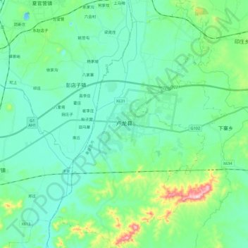
Name: Lulong topographic map, elevation, terrain.

Location: Lulong, Lulong County, Qinhuangdao City, Hebei, China (39.80670 118.81223 39.97376 118.95244)

Average elevation: 71 m

Minimum elevation: 5 m

Maximum elevation: 340 m

Gear up for your next adventure:

🧥Waterproof Hiking Jacket - Protect yourself from rain and wind while hiking
💡Portable Camping Lamp - Rechargeable lamp for campsite lighting
🥾Waterproof Trail Shoes - Shoes designed to handle wet terrain
🧭GPS Outdoor Watch - Smart watch for navigation and fitness tracking in nature
Tent Footprint - Protect tent floor and increase durability

As an Amazon Associate, this site earns from qualifying purchases at no extra cost to you.