Geolocate

Xinglong County topographic map

Click on the map to display elevation.

About this map

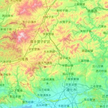
Name: Xinglong County topographic map, elevation, terrain.

Location: Xinglong County, Chengde City, Hebei, China (40.19007 117.20182 40.71226 118.25344)

Average elevation: 487 m

Minimum elevation: 16 m

Maximum elevation: 2,028 m

Gear up for your next adventure:

🧥Packable Rain Jacket - Breathable waterproof layer for unpredictable weather
🧰Survival Kit - Essential gear for emergencies in the wilderness
🧴Waterproofing Spray - Restore the DWR coating on jackets and tents
🔥Camping Stove - Portable stoves to cook outdoors with ease
🔭Compact Binoculars - Lightweight optics for scouting trails and wildlife

As an Amazon Associate, this site earns from qualifying purchases at no extra cost to you.