Geolocate

Legleg topographic map

Click on the map to display elevation.

About this map

Name: Legleg topographic map, elevation, terrain.

Location: Legleg, San Juan, La Union, Ilocos Region, 2514, Philippines (16.67902 120.35674 16.71902 120.39674)

Average elevation: 48 m

Minimum elevation: 2 m

Maximum elevation: 226 m

Other topographic maps

Click on a map to view its topography, its elevation and its terrain.
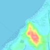
Urbiztondo Beach

Philippines > La Union > San Juan

Average elevation: 13 m

Gear up for your next adventure:

💧Reusable Water Bottle - Durable water bottles for hydration on trails
❄️Traction Ice Cleats - Slip-on spikes for icy trails and winter hiking
🥾Trail Hiking Boots - Supportive boots for rough trails
🦯Trekking Poles - Reduced impact on joints for steep topographic climbs
🧴First Aid Kit - Essential first aid supplies for outdoor emergencies

As an Amazon Associate, this site earns from qualifying purchases at no extra cost to you.