Geolocate

Levally Lower topographic map

Click on the map to display elevation.

About this map

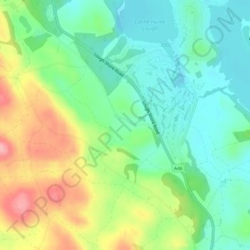
Name: Levally Lower topographic map, elevation, terrain.

Location: Levally Lower, Ulster, Northern Ireland, United Kingdom (54.38228 -7.71488 54.39514 -7.69745)

Average elevation: 83 m

Minimum elevation: 37 m

Maximum elevation: 164 m

Other topographic maps

Click on a map to view its topography, its elevation and its terrain.

Saintfield

United Kingdom > Northern Ireland

Average elevation: 87 m

Newcastle

United Kingdom > Northern Ireland

Average elevation: 115 m

Cranbrooke

United Kingdom > Northern Ireland

Average elevation: 97 m

Larne

United Kingdom > Northern Ireland > County Antrim > Larne

Average elevation: 54 m

Gear up for your next adventure:

Backpacking Tent - Lightweight tent for long-distance hiking trips
🧢Outdoor Visor - Breathable visor for sunny hikes
Lightweight Camping Tent - Portable shelter optimized for Canadian backcountry camping
🧥Thermal Layer - Insulating layer for cold outdoor conditions
🥾Trekking Boots - Durable boots for long-distance trekking

As an Amazon Associate, this site earns from qualifying purchases at no extra cost to you.