
De Bilt topographic map
Interactive map
Click on the map to display elevation.
About this map
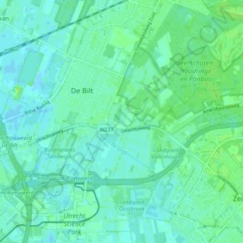
Name: De Bilt topographic map, elevation, terrain.
Location: De Bilt, Utrecht, Niederlande (52.08490 5.15617 52.12281 5.23093)
Average elevation: 4 m
Minimum elevation: -4 m
Maximum elevation: 11 m
Other topographic maps
Click on a map to view its topography, its elevation and its terrain.
Bilthoven
Niederlande > Utrecht > De Bilt
Bilthoven, De Bilt, Utrecht, Niederlande
Average elevation: 5 m
Hollandsche Rading
Niederlande > Utrecht > De Bilt
Hollandsche Rading, De Bilt, Utrecht, Niederlande
Average elevation: 6 m
Westbroek
Niederlande > Utrecht > De Bilt
Westbroek, De Bilt, Utrecht, Niederlande
Average elevation: 0 m