Geolocate

Zoverallo topographic map

Click on the map to display elevation.

About this map
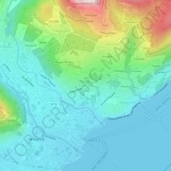
Name: Zoverallo topographic map, elevation, terrain.

Location: Zoverallo, Verbania, Verbano-Cusio-Ossola, Piedmont, 28921, Italy (45.92696 8.55464 45.96696 8.59464)

Average elevation: 322 m

Minimum elevation: 189 m

Maximum elevation: 767 m

Other topographic maps

Click on a map to view its topography, its elevation and its terrain.

Gear up for your next adventure:

🗺️Topographic Maps - Detailed maps to explore trails, mountains, and wilderness areas
🔨Vehicle Emergency Tool - Safety tool for remote road trips to trailheads
💡LED Camping Lantern - Illuminate your campsite with long-lasting lanterns
🧭GPS Handheld Device - Reliable GPS navigation for outdoor adventures
🧴Bear Spray Holster - Quick-access carry for essential Canadian wilderness safety

As an Amazon Associate, this site earns from qualifying purchases at no extra cost to you.