Geolocate

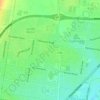
Norlane topographic map

Click on the map to display elevation.

About this map

Name: Norlane topographic map, elevation, terrain.

Location: Norlane, Geelong, Victoria, Australia (-38.10593 144.33503 -38.08155 144.37192)

Average elevation: 17 m

Minimum elevation: -8 m

Maximum elevation: 38 m

Other topographic maps

Click on a map to view its topography, its elevation and its terrain.
Armstrong Creek

Australia > Victoria > Geelong

Average elevation: 47 m

Buckley Falls Park

Australia > Victoria > Geelong

Average elevation: 43 m

Hume Reserve

Australia > Victoria > Geelong

Average elevation: 32 m

Mount Duneed

Australia > Victoria > Geelong

Average elevation: 56 m

Wombat Hill

Australia > Victoria > Geelong

Average elevation: 40 m

Vincent Park

Australia > Victoria > Geelong

Average elevation: 10 m

Lincoln Reserve

Australia > Victoria > Geelong

Average elevation: 19 m

Gear up for your next adventure:

🎒Hiking Backpack - Lightweight and ergonomic backpacks for day hikes or multi-day treks
🧦Merino Wool Socks - Moisture-wicking comfort for long-distance hiking
👟Leg Gaiters - Keep debris, mud, and snow out of your boots
🥾Mountain Trail Shoes - High-traction shoes for mountain trails
🧥Thermal Fleece Jacket - Versatile insulation for changing mountain temperatures

As an Amazon Associate, this site earns from qualifying purchases at no extra cost to you.