
Saxon topographic map
Interactive map
Click on the map to display elevation.
About this map
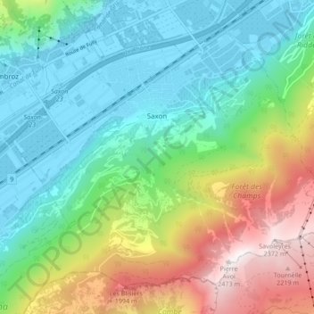
Name: Saxon topographic map, elevation, terrain.
Location: Saxon, Martigny, Vallés, 1907, Suiza (46.11354 7.14229 46.16159 7.22620)
Average elevation: 1,062 m
Minimum elevation: 460 m
Maximum elevation: 2,421 m