Geolocate

Grad Trogir topographic map

Click on the map to display elevation.

About this map

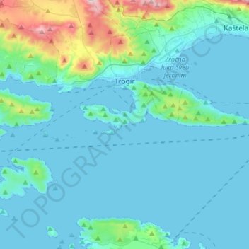
Name: Grad Trogir topographic map, elevation, terrain.

Location: Grad Trogir, Split-Dalmatia County, Croatia (43.41223 16.05312 43.55487 16.30974)

Average elevation: 70 m

Minimum elevation: -4 m

Maximum elevation: 635 m

Other topographic maps

Click on a map to view its topography, its elevation and its terrain.

Gear up for your next adventure:

🧢Outdoor Visor - Breathable visor for sunny hikes
🥾Approach Boots - Comfortable boots for hiking and climbing approaches
🥾Light Trekking Boots - Supportive boots for multi-day treks
🦟Insect Repellent - Keep mosquitoes and black flies away in wooded areas
🥾Trekking Poles - Adjustable trekking poles to reduce knee stress and improve stability

As an Amazon Associate, this site earns from qualifying purchases at no extra cost to you.