
Tyr topographic map
Interactive map
Click on the map to display elevation.
About this map
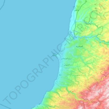
Name: Tyr topographic map, elevation, terrain.
Location: Tyr, District de Tyr, Gouvernorat du Liban Sud, 1601, Liban (33.11212 35.03640 33.43212 35.35640)
Average elevation: 120 m
Minimum elevation: -1 m
Maximum elevation: 791 m