Geolocate

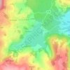
Veyrèras topographic map

Click on the map to display elevation.

About this map

Name: Veyrèras topographic map, elevation, terrain.

Location: Veyrèras, Aydat, Clermont-Ferrand, Puy-de-Dôme, Auvergne-Rhône-Alpes, France métropolitaine, 63970, France (45.63594 2.94637 45.67594 2.98637)

Average elevation: 957 m

Minimum elevation: 834 m

Maximum elevation: 1,115 m

Other topographic maps

Click on a map to view its topography, its elevation and its terrain.
Lac de la Cassière

France > Auvergne-Rhône-Alpes > Puy-de-Dôme > Aydat > La Cassière

Le lac de la Cassière se situe sur la commune d'Aydat, à côté du village de La Cassière, à environ 17 kilomètres de Clermont-Ferrand. Le lac de la Cassière est situé à 861 mètres d'altitude.

Average elevation: 911 m

63970

France > Auvergne-Rhône-Alpes > Puy-de-Dôme > Aydat

Average elevation: 924 m

Gear up for your next adventure:

💧Reusable Water Bottle - Durable water bottles for hydration on trails
🔋Solar Power Bank - Keep your GPS and devices charged during long outdoor trips
🧥Thermal Layer - Insulating layer for cold outdoor conditions
💧Hydration Bladder - Hands-free hydration solution for long treks
🛁Quick-Dry Microfiber Towel - Space-saving towel that dries rapidly on the move

As an Amazon Associate, this site earns from qualifying purchases at no extra cost to you.