Geolocate

Larkhall topographic map

Click on the map to display elevation.

About this map

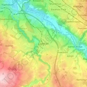
Name: Larkhall topographic map, elevation, terrain.

Location: Larkhall, South Lanarkshire, Scotland, ML9 1DR, United Kingdom (55.70011 -4.01461 55.78011 -3.93461)

Average elevation: 114 m

Minimum elevation: 20 m

Maximum elevation: 245 m

Gear up for your next adventure:

🧥Packable Rain Jacket - Breathable waterproof layer for unpredictable weather
🥽Outdoor Goggles - Protective eyewear for outdoor activities
🥾Hiking Shoes - Durable and comfortable shoes for trail hiking
🏃Hydration Running Vest - Carry water and maps close to your body for speed
🥾Light Hiking Boots - Lightweight and comfortable boots for day hikes

As an Amazon Associate, this site earns from qualifying purchases at no extra cost to you.