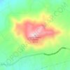
Cedros Island topographic map
Click on the map to display elevation.
Cedros Island
Cedros Island (Isla de Cedros, "island of cedars" in Spanish) is an island in the Pacific Ocean belonging to the state of Baja California, Mexico. The dry and rocky island had a population of 1,350 in 2005 and has an area of 348 square kilometres (134 sq mi) which includes the area of several small nearby islands. Cedros Island is mountainous, reaching a maximum elevation of 1,205 metres (3,953 ft). The economy is based on commercial fishing and salt production. Cedros has a distinctive flora and the traces of some of the earliest human beings in the New World. The ocean around the island is popular with sport fishermen.
About this map

Name: Cedros Island topographic map, elevation, terrain.
Average elevation: 67 m
Minimum elevation: -3 m
Maximum elevation: 1,178 m
Other topographic maps
Click on a map to view its topography, its elevation and its terrain.

Villa de Juárez (San Antonio de las Minas)
Mexico > Baja California > Municipio de Ensenada
Average elevation: 308 m


Ejido Rodolfo Sánchez Taboada
Mexico > Baja California > Municipio de Ensenada
Average elevation: 151 m

Francisco Zarco (Valle de Guadalupe)
Mexico > Baja California > Municipio de Ensenada
Average elevation: 384 m

Parque Nacional Sierra de San Pedro Mártir
Mexico > Baja California > Municipio de Ensenada
Sierra de San Pedro Mártir National Park was officially created by decree on April 26, 1947, in which 72,909 hectares were set aside and declared protected by the Mexican Federal government. The National Astronomical Observatory is located at an elevation of 2,830 m (9,280 ft). The observatory was built in…
Average elevation: 1,463 m


Ejido El Porvenir
Mexico > Baja California > Municipio de Ensenada
The valley slopes gently from northeast to southwest with an average elevation of 344 metres (1,129 ft) above sea level. The margins of the plain are composed of alluvial fans and colluvium of reddish soil from the surrounding hillsides. Chaparral grows along the rocky slopes and live oak trees can be found in…
Average elevation: 317 m
Francisco Zarco (Valle de Guadalupe)
Mexico > Baja California > Municipio de Ensenada
Average elevation: 384 m


Laguna de Santo Tomás
Mexico > Baja California > Municipio de Ensenada > La Bocana
Average elevation: 40 m