
Thank you for supporting this site ❤️
Make a donation
Make a donation
Gear up for your next adventure:
As an Amazon Associate, this site earns from qualifying purchases at no extra cost to you.
Čemšenik topographic map
Click on the map to display elevation.
Thank you for supporting this site ❤️
Make a donation
Make a donation
Gear up for your next adventure:
As an Amazon Associate, this site earns from qualifying purchases at no extra cost to you.
About this map
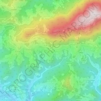
Name: Čemšenik topographic map, elevation, terrain.
Location: Čemšenik, Zagorje ob Savi, 1413, Slovenia (46.15957 14.92375 46.19957 14.96375)
Average elevation: 629 m
Minimum elevation: 320 m
Maximum elevation: 1,188 m
Thank you for supporting this site ❤️
Make a donation
Make a donation
Gear up for your next adventure:
As an Amazon Associate, this site earns from qualifying purchases at no extra cost to you.