Geolocate

Novilara topographic map

Click on the map to display elevation.

About this map
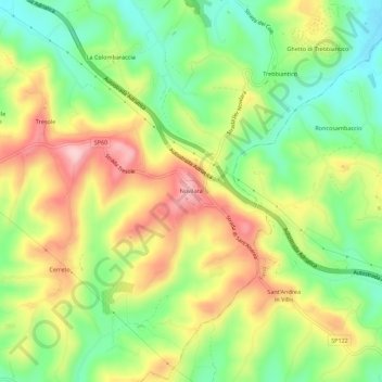
Name: Novilara topographic map, elevation, terrain.

Location: Novilara, Pesaro, Pesaro e Urbino, Marche, Italia (43.84026 12.91070 43.88026 12.95070)

Average elevation: 101 m

Minimum elevation: 7 m

Maximum elevation: 216 m

Gear up for your next adventure:

🥾Approach Boots - Comfortable boots for hiking and climbing approaches
🚑Survival Whistle - Signal for help across long distances in mountains
🚲MTB Frame Bag - Carry tools and maps directly on your bicycle frame
🧤Rechargeable Heated Gloves - Extreme warmth for Canadian winter expeditions
🧢Sun Hat - Wide-brim hat for sun protection

As an Amazon Associate, this site earns from qualifying purchases at no extra cost to you.