Geolocate

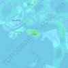
Favaro Veneto topographic map

Click on the map to display elevation.

About this map

Name: Favaro Veneto topographic map, elevation, terrain.

Location: Favaro Veneto, Venezia, Veneto, 30173, Italia (45.46463 12.24205 45.54463 12.32205)

Average elevation: 3 m

Minimum elevation: -4 m

Maximum elevation: 13 m

Other topographic maps

Click on a map to view its topography, its elevation and its terrain.

Venezia-Murano-Burano

Italia > Veneto > Venezia > Venezia > Lido

Average elevation: 1 m

Parco Monviso

Italia > Veneto > Venezia > Venezia > Favaro Veneto

Average elevation: 3 m

Burano

Italia > Veneto > Venezia > Venezia > Burano

Average elevation: 0 m

Santa Cristina

Italia > Veneto > Venezia > Venezia

Average elevation: 0 m

San Pietro

Italia > Veneto > Venezia > Venezia > Murano

Average elevation: 1 m

Gear up for your next adventure:

🛶Waterproof Dry Bags - Keep electronics and clothes dry during river crossings
🎒Backpack Rain Cover - External shield to keep your entire pack dry
🌡️Emergency Mylar Blankets - Compact thermal protection for unexpected nights outdoors
⛺Lightweight Camping Tent - Portable shelter optimized for Canadian backcountry camping
💧Hydration Bladder - Hands-free hydration solution for long treks

As an Amazon Associate, this site earns from qualifying purchases at no extra cost to you.