
Thank you for supporting this site ❤️
Make a donation
Make a donation
Gear up for your next adventure:
As an Amazon Associate, this site earns from qualifying purchases at no extra cost to you.
Pengyuan topographic map
Click on the map to display elevation.
Thank you for supporting this site ❤️
Make a donation
Make a donation
Gear up for your next adventure:
As an Amazon Associate, this site earns from qualifying purchases at no extra cost to you.
About this map
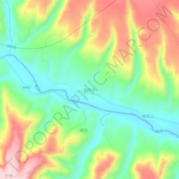
Name: Pengyuan topographic map, elevation, terrain.
Location: Pengyuan, Zhenyuan County, Qingyang, Gansu, China (35.59392 107.46109 35.63392 107.50109)
Average elevation: 1,158 m
Minimum elevation: 1,039 m
Maximum elevation: 1,328 m
Thank you for supporting this site ❤️
Make a donation
Make a donation
Gear up for your next adventure:
As an Amazon Associate, this site earns from qualifying purchases at no extra cost to you.