Geolocate

Tesila topographic map

Click on the map to display elevation.

About this map

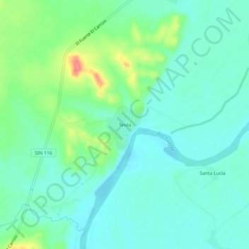
Name: Tesila topographic map, elevation, terrain.

Location: Tesila, El Fuerte, Sinaloa, Mexico (26.27035 -108.80519 26.31035 -108.76519)

Average elevation: 64 m

Minimum elevation: 45 m

Maximum elevation: 117 m

Gear up for your next adventure:

🧥Waterproof Jacket - Lightweight rain jackets for hiking and outdoor activities
🗺️Topographic Maps - Detailed maps to explore trails, mountains, and wilderness areas
🧥Insulated Jacket - Keep warm in cold outdoor conditions
🪑Ultralight Camping Stool - Compact seating for rest stops during long hikes
💧Hydration Pack - Hands-free hydration system for long hikes

As an Amazon Associate, this site earns from qualifying purchases at no extra cost to you.