
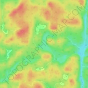
Lac à la Chaloupe topographic map
Interactive map
Click on the map to display elevation.
About this map
Name: Lac à la Chaloupe topographic map, elevation, terrain.
Average elevation: 306 m
Minimum elevation: 271 m
Maximum elevation: 333 m
Other topographic maps
Click on a map to view its topography, its elevation and its terrain.
Lac de l'Impasse
Canada > Québec > Rivière-Mistassini
Lac de l'Impasse, Rivière-Mistassini, Maria-Chapdelaine, Saguenay - Lac-Saint-Jean, Québec, Canada
Average elevation: 362 m
Lacs aux Loups
Canada > Québec > Rivière-Mistassini
Lacs aux Loups, Rivière-Mistassini, Maria-Chapdelaine, Saguenay - Lac-Saint-Jean, Québec, Canada
Average elevation: 475 m