
Rakaťa topographic map
Interactive map
Click on the map to display elevation.
About this map
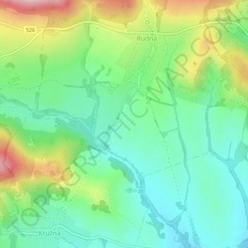
Name: Rakaťa topographic map, elevation, terrain.
Average elevation: 345 m
Minimum elevation: 268 m
Maximum elevation: 500 m
Other topographic maps
Click on a map to view its topography, its elevation and its terrain.
Pača
Slovaquie > Région de Košice > okres Rožňava
Pača, okres Rožňava, Région de Košice, Slovaquie orientale, Slovaquie
Average elevation: 865 m