
Thank you for supporting this site ❤️
Make a donation
Make a donation
Gear up for your next adventure:
As an Amazon Associate, this site earns from qualifying purchases at no extra cost to you.
Macisvenda topographic map
Click on the map to display elevation.
Thank you for supporting this site ❤️
Make a donation
Make a donation
Gear up for your next adventure:
As an Amazon Associate, this site earns from qualifying purchases at no extra cost to you.
About this map
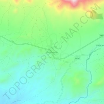
Name: Macisvenda topographic map, elevation, terrain.
Location: Macisvenda, Abanilla, Oriental, Murcia, 30648, Spanje (38.24412 -1.03916 38.28412 -0.99916)
Average elevation: 393 m
Minimum elevation: 235 m
Maximum elevation: 795 m
Thank you for supporting this site ❤️
Make a donation
Make a donation
Gear up for your next adventure:
As an Amazon Associate, this site earns from qualifying purchases at no extra cost to you.