Geolocate

Herrnhut topographic map

Click on the map to display elevation.

About this map

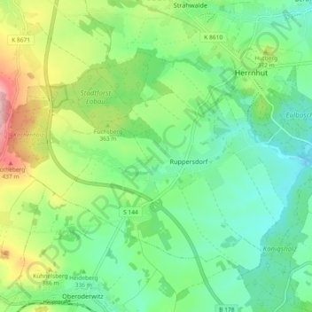
Name: Herrnhut topographic map, elevation, terrain.

Location: Herrnhut, Görlitz, Saxony, Germany (50.97910 14.67265 51.02319 14.76414)

Average elevation: 338 m

Minimum elevation: 275 m

Maximum elevation: 473 m

Gear up for your next adventure:

🕯️Camping Lantern - Illuminates your entire campsite with high-efficiency LEDs
🚲Handlebar Phone Mount - View topographic-map.com live while cycling
🥾Hiking Gaiters - Protect legs and shoes from mud, snow, and debris
🔋Lithium AA Batteries - Long-lasting power that performs in extreme cold
🧼Biodegradable Camp Soap - Environmentally friendly cleaning for gear and body

As an Amazon Associate, this site earns from qualifying purchases at no extra cost to you.