
Thank you for supporting this site ❤️
Make a donation
Make a donation
Gear up for your next adventure:
As an Amazon Associate, this site earns from qualifying purchases at no extra cost to you.
Oestrich-Winkel topographic map
Click on the map to display elevation.
Thank you for supporting this site ❤️
Make a donation
Make a donation
Gear up for your next adventure:
As an Amazon Associate, this site earns from qualifying purchases at no extra cost to you.
About this map
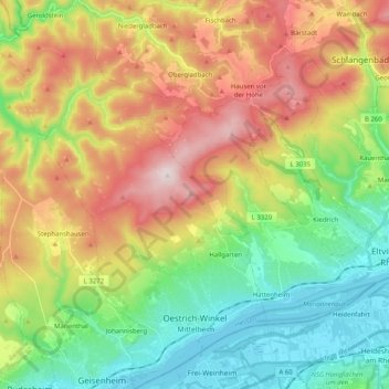
Name: Oestrich-Winkel topographic map, elevation, terrain.
Location: Oestrich-Winkel, Rheingau-Taunus-Kreis, Hesse, 65375, Germany (49.98342 7.91156 50.11297 8.05466)
Average elevation: 299 m
Minimum elevation: 78 m
Maximum elevation: 626 m
Thank you for supporting this site ❤️
Make a donation
Make a donation
Gear up for your next adventure:
As an Amazon Associate, this site earns from qualifying purchases at no extra cost to you.