Geolocate

Raunheim topographic map

Click on the map to display elevation.

About this map

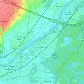
Name: Raunheim topographic map, elevation, terrain.

Location: Raunheim, Kreis Groß-Gerau, Hesse, 65479, Germany (49.99036 8.42411 50.03720 8.51999)

Average elevation: 98 m

Minimum elevation: 84 m

Maximum elevation: 150 m

Gear up for your next adventure:

Lightweight Camping Tent - Portable shelter optimized for Canadian backcountry camping
🔥Emergency Fire Starter - Reliable ignition source for all weather conditions
🔥Camping Stove - Portable stoves to cook outdoors with ease
🧭GPS Outdoor Watch - Smart watch for navigation and fitness tracking in nature
🥾Trekking Poles - Adjustable trekking poles to reduce knee stress and improve stability

As an Amazon Associate, this site earns from qualifying purchases at no extra cost to you.