Geolocate

Penig topographic map

Click on the map to display elevation.

About this map

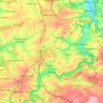
Name: Penig topographic map, elevation, terrain.

Location: Penig, Mittelsachsen, Saxony, 09322, Germany (50.90164 12.61727 51.00697 12.77007)

Average elevation: 254 m

Minimum elevation: 166 m

Maximum elevation: 341 m

Gear up for your next adventure:

🩹Compact First Aid Kit - Pre-packed essentials for common trail injuries
🔋Lithium AA Batteries - Long-lasting power that performs in extreme cold
🧤Thermal Hiking Gloves - Grip-enhanced gloves for cold-weather altitude trekking
🧥Softshell Jacket - Windproof and breathable jacket for hiking
🥾Hiking Boots - Sturdy boots providing ankle support and traction on rugged trails

As an Amazon Associate, this site earns from qualifying purchases at no extra cost to you.