Geolocate

Chiappera topographic map

Click on the map to display elevation.

About this map

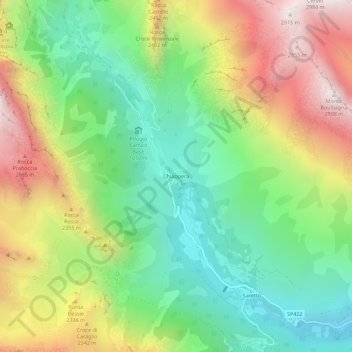
Name: Chiappera topographic map, elevation, terrain.

Location: Chiappera, Acceglio, Cuneo, Piemonte, Italia (44.47222 6.90508 44.51222 6.94508)

Average elevation: 2,032 m

Minimum elevation: 1,451 m

Maximum elevation: 2,892 m

Gear up for your next adventure:

🎒Fully Waterproof Backpack - Total protection for photography gear and electronics
🧰Survival Kit - Essential gear for emergencies in the wilderness
🧥Softshell Hiking Jacket - The perfect balance of wind protection and breathability
🧴Waterproofing Spray - Restore the DWR coating on jackets and tents
❄️Traction Ice Cleats - Slip-on spikes for icy trails and winter hiking

As an Amazon Associate, this site earns from qualifying purchases at no extra cost to you.