
Pelt topographic map
Interactive map
Click on the map to display elevation.
About this map
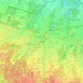
Name: Pelt topographic map, elevation, terrain.
Location: Pelt, Maaseik, Limburg, Flanders, Belgium (51.16426 5.32014 51.27640 5.52905)
Average elevation: 44 m
Minimum elevation: 25 m
Maximum elevation: 64 m