Geolocate

Kainchi topographic map

Click on the map to display elevation.

About this map

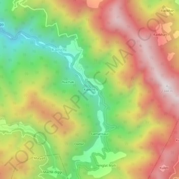
Name: Kainchi topographic map, elevation, terrain.

Location: Kainchi, Kosya Kutauli, Nainital District, Uttarakhand, India (29.40226 79.49310 29.44226 79.53310)

Average elevation: 1,762 m

Minimum elevation: 1,207 m

Maximum elevation: 2,311 m

Gear up for your next adventure:

🔋Solar Power Bank - Keep your GPS and devices charged during long outdoor trips
🔭Compact Monocular - One-handed bird watching and trail spotting
🛶Canoe Life Vest - Safety vest for water sports
🛏️Camping Sleeping Mat - Comfortable mats for sleeping outdoors
💡Compact LED Flashlight - Powerful and portable flashlight for outdoor use

As an Amazon Associate, this site earns from qualifying purchases at no extra cost to you.