
Thank you for supporting this site ❤️
Make a donation
Make a donation
Gear up for your next adventure:
As an Amazon Associate, this site earns from qualifying purchases at no extra cost to you.
Fregona topographic map
Click on the map to display elevation.
Thank you for supporting this site ❤️
Make a donation
Make a donation
Gear up for your next adventure:
As an Amazon Associate, this site earns from qualifying purchases at no extra cost to you.
About this map
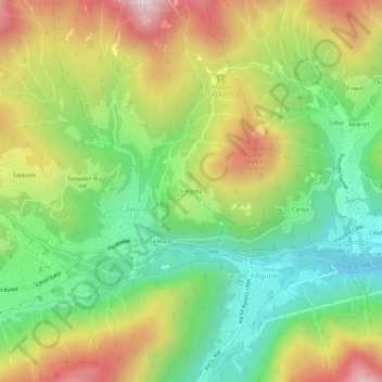
Name: Fregona topographic map, elevation, terrain.
Location: Fregona, Canale d'Agordo, Belluno, Veneto, 32020, Italia (46.34891 11.88589 46.38891 11.92589)
Average elevation: 1,276 m
Minimum elevation: 898 m
Maximum elevation: 1,807 m
Thank you for supporting this site ❤️
Make a donation
Make a donation
Gear up for your next adventure:
As an Amazon Associate, this site earns from qualifying purchases at no extra cost to you.