Geolocate

Stockstadt am Rhein topographic map

Click on the map to display elevation.

About this map

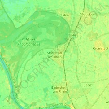
Name: Stockstadt am Rhein topographic map, elevation, terrain.

Location: Stockstadt am Rhein, Kreis Groß-Gerau, Hesse, 64589, Germany (49.78393 8.38458 49.82900 8.50569)

Average elevation: 89 m

Minimum elevation: 80 m

Maximum elevation: 96 m

Gear up for your next adventure:

🧥Insulated Jacket - Keep warm in cold outdoor conditions
🧰Multitool Knife - Compact and versatile tool for outdoor use
👟Leg Gaiters - Keep debris, mud, and snow out of your boots
🛌Insulated Sleeping Pad - Critical thermal barrier between you and the cold ground
🛶Kayak Dry Bag - Waterproof storage for kayaking adventures

As an Amazon Associate, this site earns from qualifying purchases at no extra cost to you.