Geolocate

Balaton topographic map

Click on the map to display elevation.

About this map

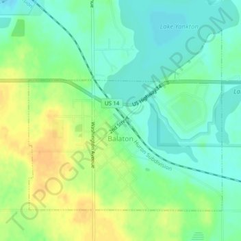
Name: Balaton topographic map, elevation, terrain.

Location: Balaton, Lyon County, Minnesota, United States (44.22523 -95.88662 44.24546 -95.85633)

Average elevation: 471 m

Minimum elevation: 457 m

Maximum elevation: 490 m

Other topographic maps

Click on a map to view its topography, its elevation and its terrain.

Golden Pond

United States > Minnesota > Lyon County > Marshall

Average elevation: 358 m

Gear up for your next adventure:

🔦LED Flashlight - Powerful and long-lasting flashlight for camping and emergencies
👟Sport Hiking Sandals - Breathable footwear for water crossings and camp rest
🥾Trail Hiking Boots - Supportive boots for rough trails
🚲Heavy Duty Bike Lock - Secure your bike at the trailhead or during stops
🥽Outdoor Goggles - Protective eyewear for outdoor activities

As an Amazon Associate, this site earns from qualifying purchases at no extra cost to you.