Geolocate

Chilete topographic map

Click on the map to display elevation.

About this map

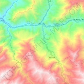
Name: Chilete topographic map, elevation, terrain.

Location: Chilete, Province of Contumazá, Cajamarca, Peru (-7.29974 -78.90648 -7.21417 -78.74211)

Average elevation: 1,817 m

Minimum elevation: 707 m

Maximum elevation: 3,135 m

Other topographic maps

Click on a map to view its topography, its elevation and its terrain.

Romero

Peru > Cajamarca > Encañada

Average elevation: 3,224 m

Gear up for your next adventure:

🧤Thermal Hiking Gloves - Grip-enhanced gloves for cold-weather altitude trekking
🥾Mountain Hiking Shoes - Shoes with superior grip for mountainous terrain
🦶Hiking Shoe Insoles - Added support for high arches and long days on feet
🧰Emergency Multi-Tool - Compact multi-tool for outdoor survival
🥾Waterproof Hiking Boots - Essential footwear for rugged terrain and wet Canadian trails

As an Amazon Associate, this site earns from qualifying purchases at no extra cost to you.