
Thank you for supporting this site ❤️
Make a donation
Make a donation
Gear up for your next adventure:
As an Amazon Associate, this site earns from qualifying purchases at no extra cost to you.
Turrilla topographic map
Click on the map to display elevation.
Thank you for supporting this site ❤️
Make a donation
Make a donation
Gear up for your next adventure:
As an Amazon Associate, this site earns from qualifying purchases at no extra cost to you.
About this map
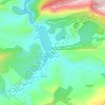
Name: Turrilla topographic map, elevation, terrain.
Location: Turrilla, Nerpio, Albacete, Castilla-La Mancha, España (38.16278 -2.27551 38.20278 -2.23551)
Average elevation: 1,072 m
Minimum elevation: 909 m
Maximum elevation: 1,484 m
Thank you for supporting this site ❤️
Make a donation
Make a donation
Gear up for your next adventure:
As an Amazon Associate, this site earns from qualifying purchases at no extra cost to you.