
Make a donation
Gear up for your next adventure:
As an Amazon Associate, this site earns from qualifying purchases at no extra cost to you.
Pannonian Basin topographic map
Click on the map to display elevation.
Make a donation
Gear up for your next adventure:
As an Amazon Associate, this site earns from qualifying purchases at no extra cost to you.
Pannonian Basin
Pannonian basin vs Carpathian basin: On the territory of present-day Hungary the ancient Roman Pannonia province was located only on Transdanubian territories, however the Great Hungarian Plain was not part of Pannonia province. This comprises less than 29% of modern Hungary, therefore Hungarian geographers avoid the terms "Pannonian Basin" and especially the "Pannonian Plain" terms due to it being considered not only unhistorical but also topologically erroneous term. Because the term "Pannonian" has historically not applied to 80% of the basin's territory, Hungarian geographers and historians use the more accurate term "Carpathian Basin". The other logical problem with the Pannonian "Plain" terminology lies in topography: with the exception of Little Hungarian Plain (which is only around 15% of the territory of ancient Pannonian Transdanubia) hills and mountains dominate the landscape, so real plains are very rare on that territory. The largest plain of Ancient Roman Pannonia province is located in Slavonia in Croatia and Voivodine in modern Serbia.
Make a donation
Gear up for your next adventure:
As an Amazon Associate, this site earns from qualifying purchases at no extra cost to you.
About this map
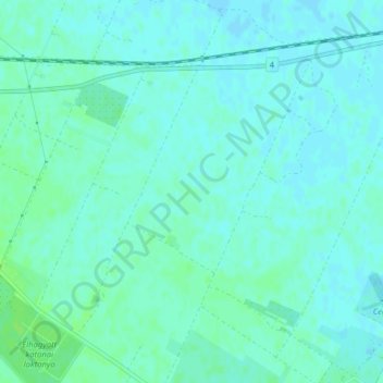
Name: Pannonian Basin topographic map, elevation, terrain.
Average elevation: 99 m
Minimum elevation: 95 m
Maximum elevation: 104 m
Make a donation
Gear up for your next adventure:
As an Amazon Associate, this site earns from qualifying purchases at no extra cost to you.