Geolocate

Baghi topographic map

Click on the map to display elevation.

About this map

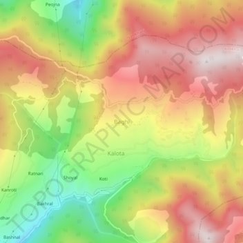
Name: Baghi topographic map, elevation, terrain.

Location: Baghi, Kotkhai, Shimla, Himachal Pradesh, India (31.21693 77.53648 31.25693 77.57648)

Average elevation: 2,576 m

Minimum elevation: 2,037 m

Maximum elevation: 3,039 m

Gear up for your next adventure:

🧥Fleece Jacket - Warm and lightweight jacket for layering
🎒Backpack Rain Cover - External shield to keep your entire pack dry
Backpacking Tent - Lightweight tent for long-distance hiking trips
🥾Lightweight Hiking Shoes - Comfortable shoes for day hikes
🔭Compact Monocular - One-handed bird watching and trail spotting

As an Amazon Associate, this site earns from qualifying purchases at no extra cost to you.