Geolocate

Gachie topographic map

Click on the map to display elevation.

About this map

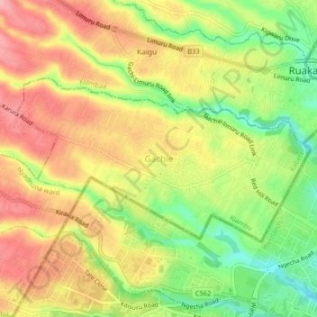
Name: Gachie topographic map, elevation, terrain.

Location: Gachie, Kihara ward, Kabete, Kiambu, 43563, Kenya (-1.23676 36.74617 -1.19676 36.78617)

Average elevation: 1,777 m

Minimum elevation: 1,712 m

Maximum elevation: 1,830 m

Gear up for your next adventure:

🧢Hiking Hat - Sun-protective and breathable hats for long treks
🧥Softshell Hiking Jacket - The perfect balance of wind protection and breathability
🥾Durable Hiking Shoes - Long-lasting shoes for frequent hiking
🧶550 Survival Paracord - Versatile utility cord for emergency repairs and rigging
🍽️Titanium Camping Spork - Ultralight and indestructible eating utensil

As an Amazon Associate, this site earns from qualifying purchases at no extra cost to you.