Geolocate

Anapoima topographic map

Click on the map to display elevation.

About this map

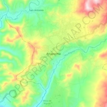
Name: Anapoima topographic map, elevation, terrain.

Location: Anapoima, Tequendama, Cundinamarca, Colombia (4.50930 -74.57591 4.58930 -74.49591)

Average elevation: 680 m

Minimum elevation: 436 m

Maximum elevation: 1,078 m

Gear up for your next adventure:

🧰Survival Kit - Essential gear for emergencies in the wilderness
Camping Groundsheet - Protect your tent from moisture and dirt
🧊Portable Cooler - Keep food and drinks cold during outdoor adventures
🧭GPS Tracker - Track your location in remote areas safely
🥾Mountain Trail Shoes - High-traction shoes for mountain trails

As an Amazon Associate, this site earns from qualifying purchases at no extra cost to you.