
Guateque topographic map
Click on the map to display elevation.
Guateque
Guateque is a town and municipality in the Colombian Department of Boyacá, part of the subregion of the Eastern Boyacá Province. Guateque's urban center is located at an altitude of 1,815 metres (5,955 ft) on the Altiplano Cundiboyacense at distances of 125 kilometres (78 mi) from the department capital Tunja and 112 kilometres (70 mi) from Bogotá, capital of Colombia. It borders the municipalities of La Capilla, Tenza, Sutatenza, Somondoco of Boyacá and Tibiritá and Manta of Cundinamarca.
About this map
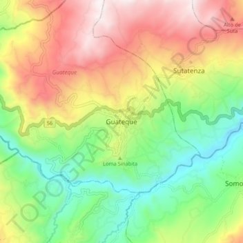
Name: Guateque topographic map, elevation, terrain.
Location: Guateque, Oriente, Boyacá, 153050, Colombia (4.96629 -73.51313 5.04629 -73.43313)
Average elevation: 1,790 m
Minimum elevation: 1,294 m
Maximum elevation: 2,435 m