Geolocate

Hanford topographic map

Click on the map to display elevation.

About this map

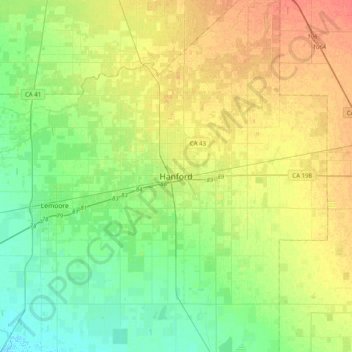
Name: Hanford topographic map, elevation, terrain.

Location: Hanford, Kings County, California, 93230, United States (36.16745 -119.80568 36.48745 -119.48568)

Average elevation: 74 m

Minimum elevation: 58 m

Maximum elevation: 94 m

Gear up for your next adventure:

🧣Evaporative Cooling Towel - Beat the heat during intense summer climbs
🔭Compact Monocular - One-handed bird watching and trail spotting
🥾Hiking Gaiters - Protect legs and shoes from mud, snow, and debris
🧥Ultralight Puffy Jacket - Maximum warmth that packs down to the size of an orange
💡LED Camping Lantern - Illuminate your campsite with long-lasting lanterns

As an Amazon Associate, this site earns from qualifying purchases at no extra cost to you.