
Delicate Arch topographic map
Click on the map to display elevation.
Delicate Arch
Delicate Arch is one of the main tourist draws in Arches National Park. The parking lot at the Delicate Arch Trailhead, although large, fills up quickly on most days. The trail to Delicate Arch is 3 miles (4.8 kilometer) round trip with an elevation change of 480 feet (146 meters). The trail is well defined for the first 1/2 mile, then does a steep incline over open rock. There is a narrow ledge for the last 200 yards (183 meter) before reaching the arch.
About this map
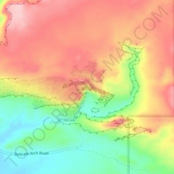
Name: Delicate Arch topographic map, elevation, terrain.
Location: Delicate Arch, Grand County, Utah, United States (38.74341 -109.49945 38.74353 -109.49913)
Average elevation: 1,409 m
Minimum elevation: 1,309 m
Maximum elevation: 1,490 m
Other topographic maps
Click on a map to view its topography, its elevation and its terrain.