Geolocate

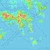
Round Island topographic map

Click on the map to display elevation.

About this map

Name: Round Island topographic map, elevation, terrain.

Location: Round Island, Southern District, Hong Kong Island, Hong Kong, China (22.21359 114.18337 22.21757 114.18832)

Average elevation: 3 m

Minimum elevation: -1 m

Maximum elevation: 119 m

Other topographic maps

Click on a map to view its topography, its elevation and its terrain.
Victoria Peak

China > Hong Kong > Hong Kong Island

Victoria Peak is a hill on the western half of Hong Kong Island. It is also known as Mount Austin, and locally as The Peak only generally. With an elevation of 552 metres (1,811 ft), it is the tallest hill on Hong Kong Island, and the 29th tallest in the territory of Hong Kong. It is a major tourist attraction…

Average elevation: 209 m

Braemar Hill

China > Hong Kong > Hong Kong Island

Average elevation: 89 m

Mount Parker

China > Hong Kong > Hong Kong Island

Average elevation: 214 m

Kung Man Village

China > Hong Kong > Hong Kong Island

Average elevation: 46 m

Central District

China > Hong Kong > Hong Kong Island

Average elevation: 114 m

Southern District

China > Hong Kong > Hong Kong Island

Average elevation: 36 m

Mount Cameron

China > Hong Kong > Hong Kong Island

Average elevation: 153 m

Sai Wan

China > Hong Kong > Hong Kong Island

Average elevation: 81 m

Mount Davis

China > Hong Kong > Hong Kong Island

Average elevation: 71 m

Ap Lei Chau

China > Hong Kong > Hong Kong Island

Average elevation: 25 m

Gear up for your next adventure:

🧢Sun Hat - Wide-brim hat for sun protection
🧣Evaporative Cooling Towel - Beat the heat during intense summer climbs
🛶Kayak Accessories - Essential gear for safe and fun kayaking adventures
⛺Camping Groundsheet - Protect your tent from moisture and dirt
🧥Ultralight Puffy Jacket - Maximum warmth that packs down to the size of an orange

As an Amazon Associate, this site earns from qualifying purchases at no extra cost to you.