Geolocate

Daat topographic map

Click on the map to display elevation.

About this map

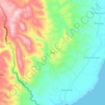
Name: Daat topographic map, elevation, terrain.

Location: Daat, Sogod, Cebu, Central Visayas, 6007, Philippines (10.77301 123.99119 10.81301 124.03119)

Average elevation: 110 m

Minimum elevation: 0 m

Maximum elevation: 281 m

Gear up for your next adventure:

👟Trail Running Shoes - Agile footwear for fast-paced topographic exploration
🎒Fully Waterproof Backpack - Total protection for photography gear and electronics
🧭GPS Outdoor Watch - Smart watch for navigation and fitness tracking in nature
🛌Down Sleeping Bag - Superior warmth-to-weight ratio for cold nights
🔥Emergency Fire Starter - Reliable ignition source for all weather conditions

As an Amazon Associate, this site earns from qualifying purchases at no extra cost to you.