Geolocate

King topographic map

Click on the map to display elevation.

About this map

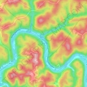
Name: King topographic map, elevation, terrain.

Location: King, Clay County, West Virginia, 25045, United States (38.48177 -81.25123 38.52177 -81.21123)

Average elevation: 289 m

Minimum elevation: 183 m

Maximum elevation: 388 m

Gear up for your next adventure:

🥾Lightweight Hiking Shoes - Comfortable shoes for day hikes
🥾Trail Hiking Boots - Supportive boots for rough trails
🧰Multitool Knife - Compact and versatile tool for outdoor use
💧Filtered Water Bottle - Safe drinking water on the go
🧦Hiking Socks - Moisture-wicking and comfortable socks for long hikes

As an Amazon Associate, this site earns from qualifying purchases at no extra cost to you.